UM students model the Clark Fork River, Smurfit contamination
Laura Lundquist
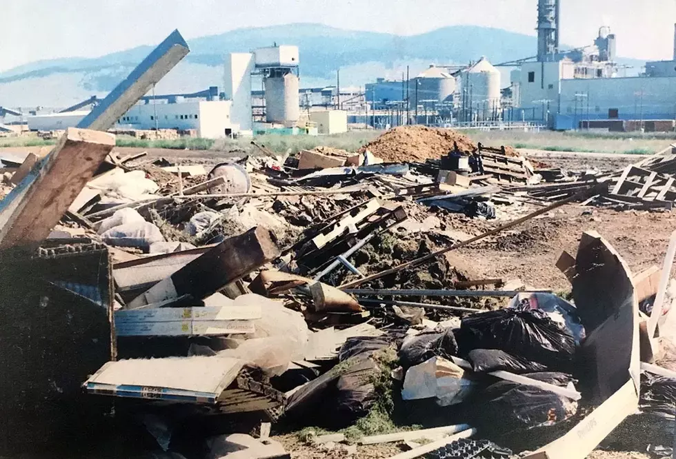
(Missoula Current) University of Montana graduate students have modeled various aspects of the Clark Fork River near the Smurfit Stone mill site in hopes of getting the Environmental Protection Agency to do the same before a cleanup process is chosen.
On Monday night, the Watershed Education Network, a local nonprofit, hosted a discussion of the current status of the EPA cleanup of the Smurfit Stone mill site, with a focus on what sampling locals would like to see and why people should care about soil and water sampling on the site. Representatives of Missoula County, the University of Montana and the Frenchtown Smurfit Stone Community Advisory Group gave short presentations followed by a question-and-answer session.
Elena Evans, Missoula County Environmental health manager, said getting the EPA to do a thorough job of sampling has been challenging. The agency looks only at direct risks to human health and will leave contaminants in place if a risk is not identified. The agency has its Superfund process, which is fairly rigid, and is usually reluctant to do much more than the minimum, said Community Advisory Group member Bruce Sims.
“In some ways, I believe (the Superfund process) was used as a shield against more intensive work that we would have liked to have seen done. I think we’ve gone a long way toward improving the situation. But it seemed to me that it wasn’t a very responsive process to our local needs and concerns,” Sims said.
The Community Advisory Group and the county have lobbied for seven years to get the agency to do more groundwater and soil sampling on the pulp-mill site that produced varying amounts of contaminants from processing wood products for 53 years. But Evans is hopeful that the additional sampling the EPA agreed to carry out this year will give the public a better idea of how much contamination exists at the site so that an eventual cleanup effort can deal with most of it.
“There is a very real reason that people need to stay interested throughout this very long process,” Evans said. “Development of this site will certainly occur. We’ve all seen rapid development in the area. And there have already been applications for developing residential mixed-use to 8,000 people – that’s the size of Hamilton.”
Flooding could pose a risk, but the agency hasn’t looked at what would happen in such an event. For example, the EPA has balked at removing the earthen berm that separates the river from the mill site, saying it doesn’t contain contamination so they don’t need to move it. But the county, the Community Advisory Group and others worry about what could happen should the berm fail and the river reclaim its old floodplain, which is now contaminated.
UM geosciences professor Andrew Wilcox said his graduate students saw that the EPA had done little to investigate the site’s interaction with the river. Sampling can answer some questions, but computer models can also fill in some gaps. So this past fall, the students took it upon themselves to develop a few computer models to provide some answers.
“We are at a point (in the Superfund process) where there’s not a very strong scientific basis of understanding of the river floodplain/water movement/contaminant transport processes at this site. As a basis for developing a remediation plan that is informed by science, we need that,” Wilcox said.
Over the winter, the eight students analyzed or modeled seven aspects of the site, from groundwater flow and contamination movement under the site to the risk of larger floods on the Clark Fork River driven by climate change. They published their results this month.
Their groundwater model shows that contaminated groundwater under the mill site’s wastewater ponds moves west-northwest toward the river and “into deeper sedimentary units that host groundwater resources used for human purposes.” So buried dioxins, furans and PCBs could still be flowing into the river. Wilcox said the model was a start but more modeling was needed to completely understand the system.
When the students modeled the Clark Fork River under two climate-change scenarios in based on less and greater emissions by 2050, they found a 4 to 7% increase in total annual precipitation and a 19 to 36% increase in the number of days with extreme precipitation similar to the event that caused the Yellowstone River to experience a 500-year flood in 2022.
“It’s not just the averages that matter but also the extremes. We expect for reasons of physics that there will be an increasing propensity for extreme events that will generate extreme floods or extreme droughts,” Wilcox said. “In terms of the river accessing its floodplain, creating stresses on the berms either through overtopping or creating things like boils, it’s the extremes that we’re concerned about.”
The students also used the high water year of 2018 to model what would happen to the site in the event of a 100-year, 200-year and 500-year flood. None of the floods are predicted to overtop the berm, but berm failure is still a low-probability possibility. So the students recommended that the berm be reinforced if it is to be left in place.
Wilcox said more modeling is needed, but his students have provided the EPA with a quick example of what could be done.
“This provides a scientific basis, a start for thinking about climate, groundwater flow, river processes and hydraulics of large floods that should be pursued and points toward future studies that could be done as part of the Superfund process,” Wilcox said. “The goal was to lay out ‘here are some models, here are some data and here are some things we think we could build on.’”
Contact reporter Laura Lundquist at lundquist@missoulacurrent.com.
30 Items That Montana Goodwill Will NOT Accept
Gallery Credit: KC


