Sick of Clouds and Fog? Here’s Why Western Montana is So Cloudy
If you're tired of the cloudy, and frequently foggy weather this winter you can blame the geography of Western Montana.
It's a scenario many new arrivals might find upsetting, after seeing all the pictures of "bluebird days" in the winter before moving here. And National Weather Service forecasters say conditions like these make forecasting tough too.
This winter is turning into a classic example of the problems with Western Montana geography in the middle of the winter. Day after day of overcast weather, little sun and fog blanketing the valleys.
Meteorologist Dave Noble says we can blame our landscape's combination of high mountains and valleys filled with rivers and lakes.
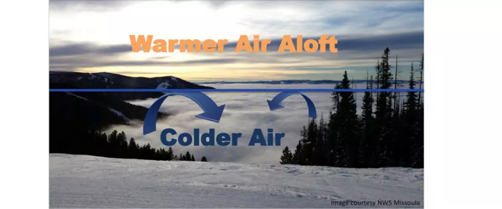
"This sort of situation can be tough to eliminate, especially if you have like no wind or lack of sunshine. Strong high pressure over us for multiple days, so the temperature inversions can create fog. You can have sound issues, and air stagnation."
Flathead Lake is a major weather generator, and from late October through February, condensation, even from smaller lakes and all our rivers, provides a problematic source of moisture.
"You know you have cold air trapped in the valleys, so it's stable," Noble explains. "You have particulates that are accumulating every day. And so the air pollution gets worse and worse and worse. You know, usually, there's stagnant, high pressure over us, and that just hangs for a long time."
NWS graphic; Dave Noble
NWS graphic; Dave Noble
It's all about the mixing
So much so that it can take a considerable shift in the weather, usually in the form of a cold front, to provide "mixing" to push out the stagnant air. And that's often just temporary relief. It's not dissimilar to summer when inversions can trap fire smoke in the valleys for days on end, until a cold front comes through.
"And when the cold front comes through, it actually mixes up colder air out and brings in the cold front air from the Pacific. And it's usually milder and sometimes dramatically milder, so we don't start feeling the cooler air until the winds kind of dies down the next day," Noble says. "High pressure builds, you know. You get radiational cooling at night, and the temperature inversion starts developing again."
High pressure is good for the high country, not the valleys
And often at this point in the winter, although not so much this year, that high pressure effectively puts a lid on things and blocks out weather changes.
"The snow is starting to get kind of crunchy in the mountains. People are kind of like 'when's the snow going to fall?' You know and that's when we got the temperature inversions. So you start seeing an increase of fog and stratus in the valley especially further north like Flathead Valley, Mission Valley because of Flathead Lake."
Don't like clouds? Move to Butte
In fact, Noble says Kalispell can be somewhat worse, with 60-to-70 percent cloudy days, and Missoula not far behind. If you want relief, go to Butte where clouds can only be a problem 20 percent of the time.
NWS graphic; Dave Noble
NWS graphic; Dave Noble
NWS graphic; Dave Noble
NWS graphic; Dave Noble
And finding your way through the fog isn't just your problem. It also makes winter forecasting harder.
"It's not easy sometimes to find the fronts because the mountains and all the cold areas kind of locked in the valleys. Sometimes even if a cold front moves through and it's a weak cold front, it may not even mix out the temperature inversion. So it's not always a clear-cut forecast sometimes."


